


Our Vision

and contributing meaningfully to the global community.
About
The collaboration between KGEO, KMUTT (Thailand) and Universitas Pendidikan Ganesha (Indonesia) was founded on a shared vision to create an open space for learning, research, and innovation. With an MoU already established and a MoA to be signed in 2025, this partnership stands as an international bridge focused on computer science, software engineering, geospatial technology, and digital innovation
Our mission is clear: To generate academic and technological breakthroughs, provide meaningful experiences for students and lecturers, and deliver real benefits to society. From joint publications and academic events to research engaging local governments, this collaboration continues to grow as an inclusive platform for fresh ideas.
We warmly welcome students, researchers, and partners to join us, because innovation knows no boundaries, and collaboration makes it possible.
Focus Field
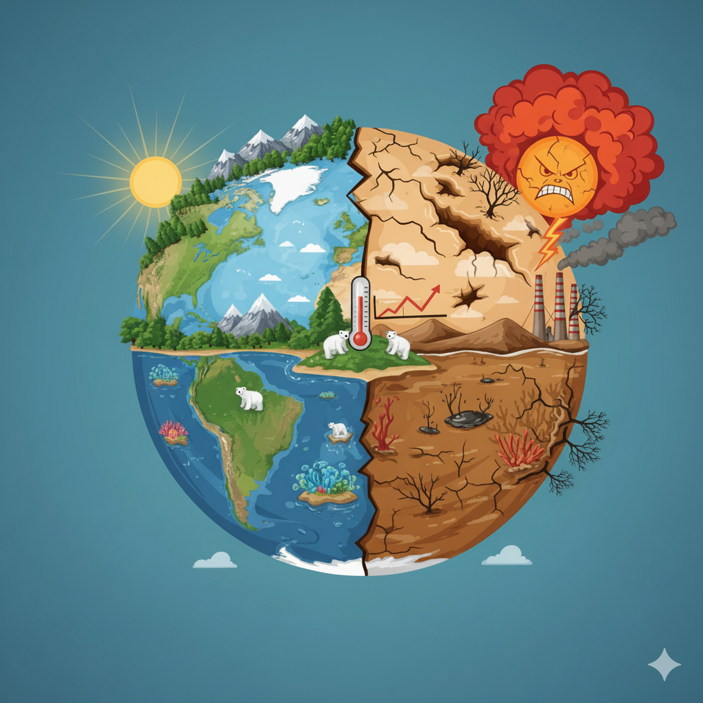
- Geospatial Studies (Water Management, Climate Change)
- Artificial Intelligence
- Data Science
- Software Engineering
- Web-GIS
- IoT
Partners
-
Faculty of Engineering and Vocational (Undiksha, Indonesia)
- Applied Bachelor in Software Engineering Technology Study Program
- Bachelor of Computer Science Study Program
-
Faculty of Science (KMUTT, Thailand)
- KGEO (KMUTT, Thailand)
Our Journey & Activities
Key milestones in our collaborative journey
2018
Sign MoU
Formalized the collaboration between Undiksha, Indonesia, and KMUTT, Thailand
2019
Events and Workshop
Attending events/workshop, such as Remote Sensing of Land-Use/Cover Change and Climate Impacts in Coastal Zone” in Phuket, Thailand
2023
Research Collaboration
Research funded (Univ.), Student internships, Presentation in Conferences, Prototype, Bachelor Thesis, Academic Activities, MoU (ext.)
2024
Research Collab #2
Research funded (Univ. and Govt.), Student Internship, Publications (Conference), Guest Lecture, Bachelor Thesis & Projects, other Academic Activities
2025
Research Collab #3
Research funded (Univ.), Students Internship, Publications (conference and journals), Guest Lecture, MoA between Faculties
Publications & Products
Papers, articles, or journals that we have published
Abstract Presentation
K.H. Sudana, L.J.E Dewi, K. Setemen, P. Varnakovida, K.Y.E. Aryanto, 2024, Machine Learning-Based Analysis of Rice Crop Phenology in Satellite Imagery, ICMLSC 2024 Singapore [Abstract]. Achievement: Best Presenter
L.J.E. Dewi, K.Y.E. Aryanto, G. Indrawan, K.A. Seputra, P. Varnakovida, 2024, Crop Classification Model using Convolutional Neural Network Algorithm, ICMLSC 2024 Singapore [Abstract]
K.P.G.M. Dinata, L.J.E. Dewi, P. Varnakovida, K.Y.E. Aryanto, 2024, A Comparative Analysis of Machine Learning Algorithms for Land Use and Land Cover Classification in Chachoengsao Province, Thailand, ICMLSC 2024 Singapore [Abstract]
K.L. Prawira, K.Y.E. Aryanto, P. Varnakovida, 2024, Analysis of object-based land use and land cover classification with SNIC and G-means algorithms, 9th International Conference on Sustainable Energy and Environment (SEE 2024), Bangkok [Abstract]
N.P.K. Dewi, P. Varnakovida, K.Y.E. Aryanto, N. Yensakunsuk, 2024, River area segmentation using Sentinel-1 SAR imagery with deep learning approach, 9th International Conference on Sustainable Energy and Environment (SEE 2024), Bangkok [Abstract]
M. Damayanti, N. Yensakunsuk, K.Y.E. Aryanto, P. Varnakovida, 2024, Forecasting SPI and SPEI drought indices using climate data and long short-term memory neural networks, 9th International Conference on Sustainable Energy and Environment (SEE 2024), Bangkok [Abstract]
Proceedings & Journals
F. B. Pasaribu, L. J. E. Dewi, K. Y. E. Aryanto, K. A. Seputra, P. Varnakovida and N. K. Kertiasih, "Generating synthetic data on agricultural crops with DCGAN," 2024 11th International Conference on Advanced Informatics: Concept, Theory and Application (ICAICTA), Singapore, 2024, pp. 1-6, doi: 10.1109/ICAICTA63815.2024.10763158.
F.B. Pasaribu, L.J.E. Dewi, K.Y.E. Aryanto, P. Varnakovida, 2025, Effect of Synthetic Data Augmentation on Plant Classification Accuracy Using MobileNetV2, EfficientNet-B0, and ResNet-18, IEEE 5th International Conference on Software Engineering and Artificial Intelligence (SEAI), China. https://doi.org/10.1109/SEAI65851.2025.11108883 [Proceeding]
Dewi, N. P. K., Suputra, P. H. ., Paramartha, A. G. Y. ., Dewi, L. J. E. ., Varnakovida, P. ., & Aryanto, K. Y. E., 2025, River Area Segmentation Using Sentinel-1 SAR Imagery with Deep-Learning Approach. Geomatics and Environmental Engineering, 19(4), 39–63. https://doi.org/10.7494/geom.2025.19.4.39
P. Ony Andewi, K. A. Seputra, K. Y. E. Aryanto, and L. J. E. Dewi, “Integrasi Teknologi Penginderaan Jauh Dan Machine Learning Pada Web GIS Untuk Pemetaan Potensi Banjir” (Integration of Remote Sensing and Machine Learning Technology in Web GIS for Flood Potential Mapping), Jurnal Pendidikan Teknologi dan Kejuruan, vol. 22, no. 1, pp. 12–23, Jan. 2025, doi: 10.23887/jptkundiksha.v22i1.87455.
N.P.N. Nathalia, G.A.R. Wijaya, K.Y.E. Aryanto, N.P.N.P. Dewi, P.H. Saputra, N.P.K. Dewi, M. Damayanti, K.L. Prawira, 2025, International Journal of Applied Sciences and Smart Technologies (IJASST), vol 7(1), pp. 145-158, https://doi.org/10.24071/ijasst.v7i1.11608
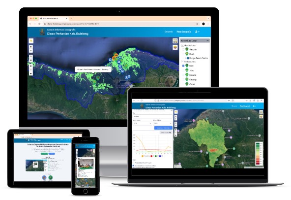
Related Project
Here are some related prototypes in the field of environmental and climate change
WEF GIS SIPETANI on Going FLood Mapping